Preserving Our Past · Celebrating Our Present · Inspiring Our Future
Traditional Governance & Place

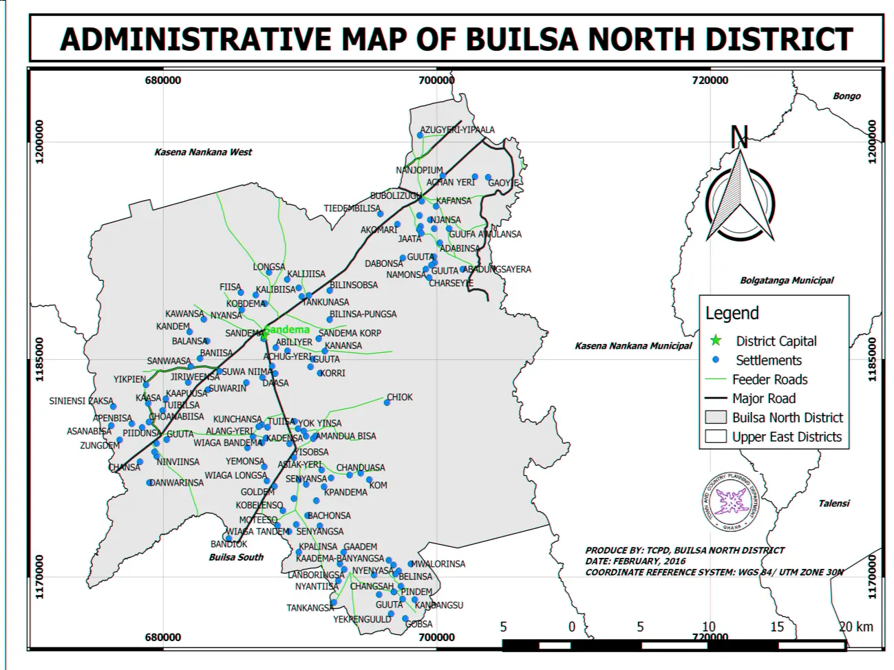
Traditional Leadership Map of Buluk

Explore the Builsa Traditional Area, divisional chiefships, constituent communities and publicly documented customary institutions through an interactive leadership map.

Institutional Map

One structure, several kinds of authority

The visual map distinguishes the paramountcy and divisional chiefships from community chiefs, sub-chiefs, Tindana/earth custodians, lineage heads, elders, kingmakers/selectors and ritual custodians where those roles have been publicly documented and approved.
Institutional Structure

From the Builsa Traditional Area to the divisions

Open any division to see its chiefship, succession record, communities, customary institutions, images, history and source evidence.

Customary Institutions

Leadership is more than a list of chiefs

These role categories are stored separately so the site can describe the institution accurately without assuming that land, ritual, lineage and political authority are identical.

Chief / traditional office

Political and ceremonial chiefship recorded through the traditional-area structure.

Community chief / sub-chief

Lower-level office serving a community, section or locality where publicly documented.

Tindana / earth custodian

Earth, land or ritual-custodianship role where locally verified for public description.

Kingmaker / selector

Person or body involved in nomination, selection or enskinment where public information is appropriate.

Clan / lineage / family head

Authority attached to kinship, lineage or family structures rather than chiefship alone.

Ritual / shrine custodian

Ritual or sacred-office context; sensitive procedures and locations remain restricted.

Geographic Context

Traditional areas in cultural geography

This reference view uses only approved public coordinates and the currently calibrated map layer. It is not a legal boundary map and should not be used to settle jurisdictional or land disputes.

Open full cultural map →
Buluk reference map
Reference modeArea pins appear only where the map has verified calibration and suitable public coordinates.
Help complete the register

Document local offices with the people who know them

Contribute palace photographs, succession histories, community-chief records, public information on Tindana/earth custodianship, selection traditions and oral histories. Sensitive cultural information should be identified as restricted rather than submitted for public display.

Contribute verified knowledge →